Spatial framework for Ilion municipality, Greece
In September 2020, I published the blog post Is it time for a planning upgrade? | Using UK planning tools as an inspiration towards a decentralised Greek planning system. This blog post was about the centralised planning system in Greece, the reasons that led to it and proposals that could potentially shift the planning system towards a more decentralised ‘dehaviour’.
Those proposals included the creation of a new planning tool, similar to Neighbourhood Planning in UK, which would have a legal status and it would be produced by the local authorities in cooperation with the locals themselves. To this day, the country’s centralised system does not offer local authorities the necessary tools to participate in discussions about high-level design and planning, which ultimately hinders locals’ participation into decision-making too. Thus, this new tool could be a first step towards a more decentralised planning system, where local authorities and locals have a more active role in decision-making regarding their municipality.
Today’s post presents a first example of how this tool could be applied in the Greek context. The brochure found below, is a summary of the Spatial Framework for Ilion report. It is a first attempt towards a spatial framework at a municipality level and an initiative to introduce a holistic approach when designing for the city that brings the national planning policies, municipality’s vision and objectives, as well as locals’ views and desires together.
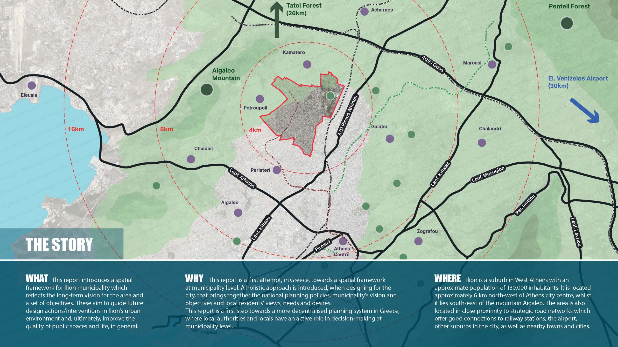
Ilion is a suburb in West Athens with an approximate population of 130,000 inhabitants. It is located approximately 6 km north-west of Athens city centre, whilst it lies south-east of the mountain Aigaleo. The area is also located in close proximity to strategic road network which offers good connections to railway stations, the airport, other suburbs in the city, as well as nearby towns and cities.
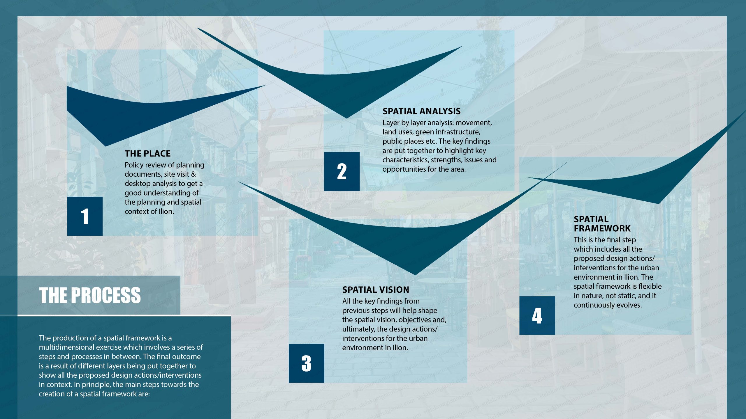
The production of a spatial framework is a multidimensional exercise which involves a series of steps and processes. The outcome is a result of different layers being put together to show all the proposed design interventions. In principle, the main steps towards the creation of a spatial framework are:
- The Place. Policy review of planning documents, site visit & desktop analysis to get a good understanding of the planning and spatial context of Ilion.
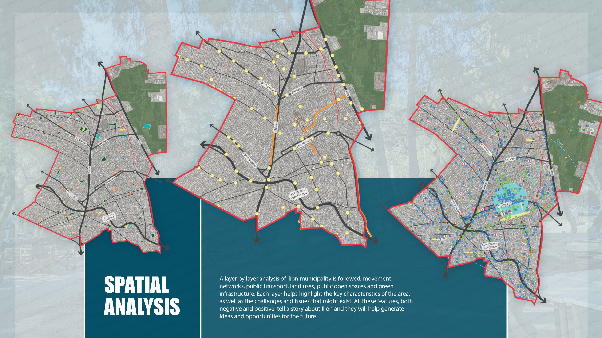
- Spatial Analysis. A layer by layer analysis: movement networks, public transport, land uses, public open spaces and green infrastructure. Each layer helps highlight the key characteristics of the area, as well as the challenges and issues that might exist. All these features, both negative and positive, tell a story about Ilion. This story will generate ideas and opportunities for the future.
- Community Engagement. A questionnaire was sent out aiming to catch a pool of people that were interested in sharing their views regarding the quality of life in the area, their aspirations and needs. Note: This was a first attempt to engage with locals and due to the lack of resourcing the number of participants was limited. However, once this tool gets formalised, then this part of the process will include community workshops, questionnaires, as well as general community gatherings to inform locals about the status of the current works.
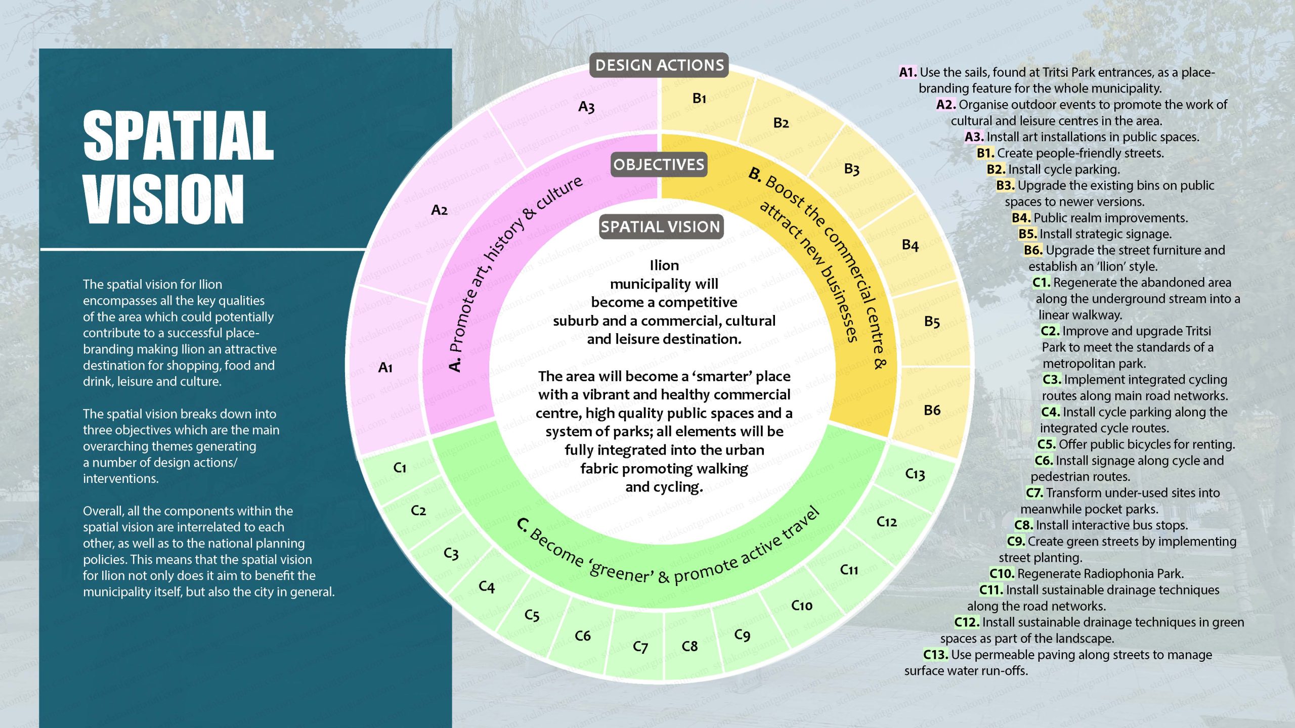
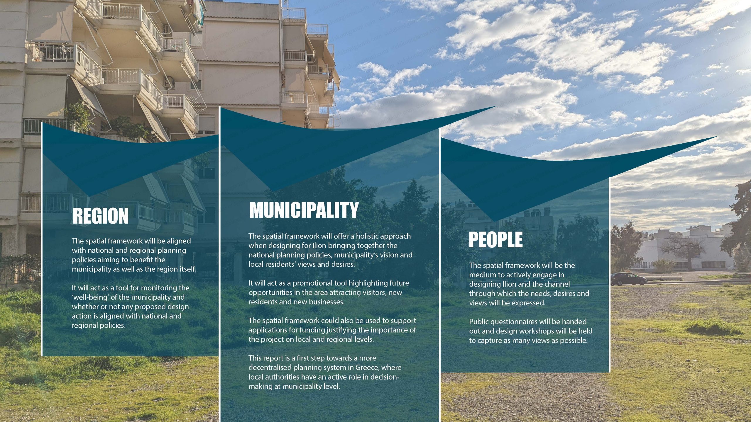
- Spatial Vision. The spatial vision encompasses all the key qualities of the area which could potentially contribute to a successful place-branding, making Ilion an attractive destination for shopping, food and drink, leisure and culture. The spatial vision breaks down into three objectives which generate a number of design actions/ interventions. Overall, all the components within the spatial vision are interrelated to each other, as well as to the national planning policies. This means that the spatial vision for Ilion aims to benefit both the municipality and Athens city.
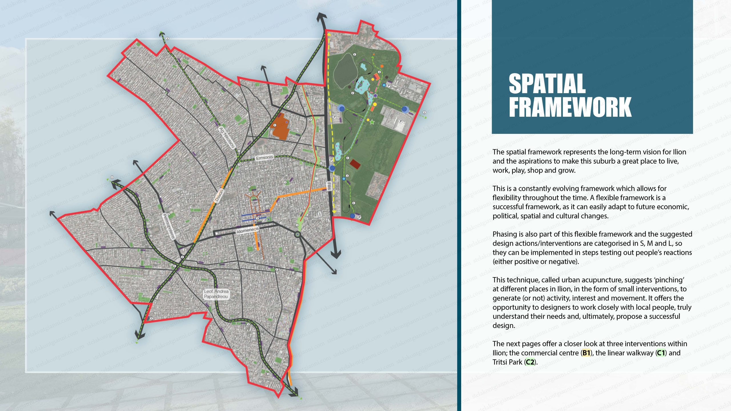
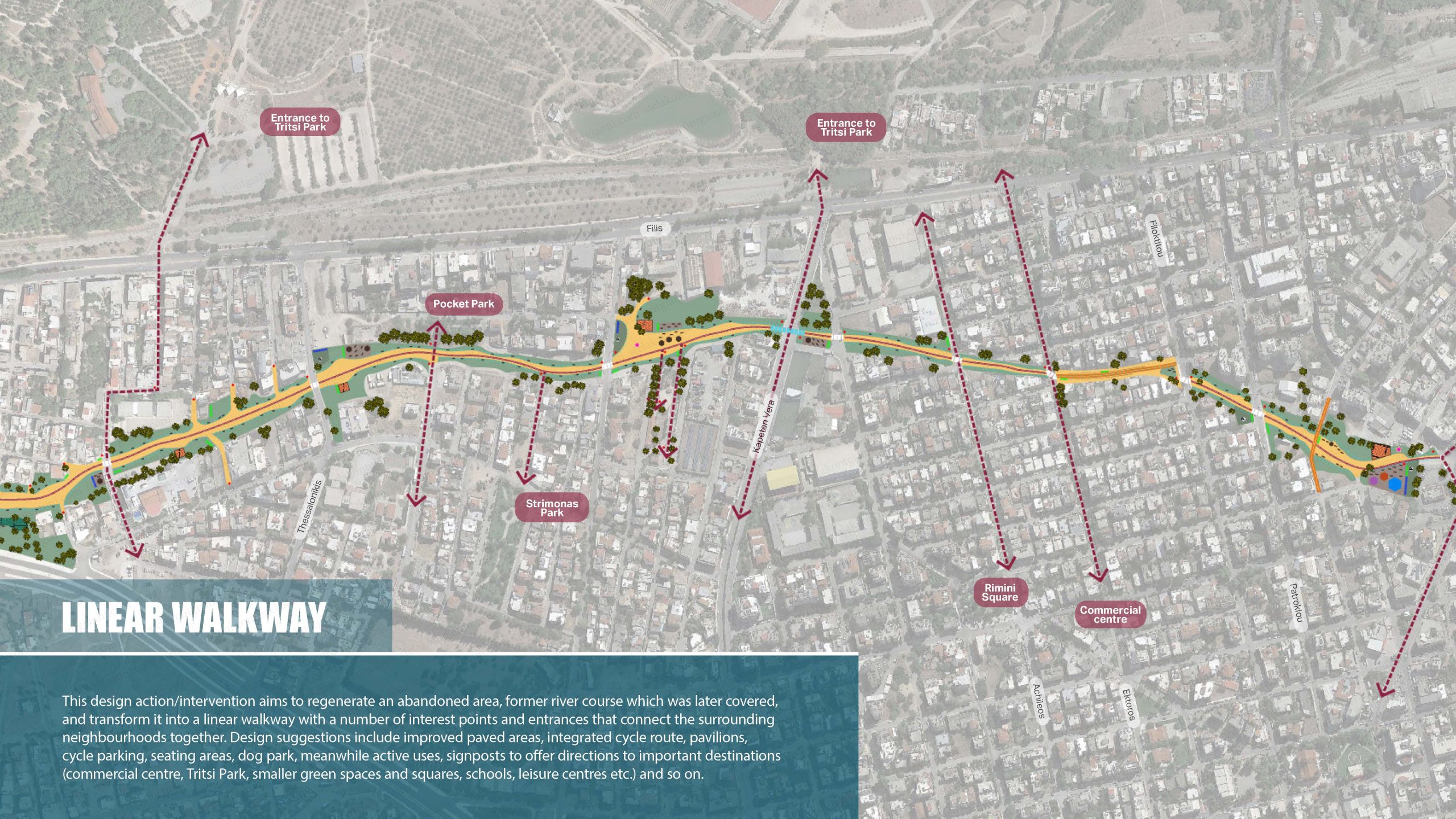
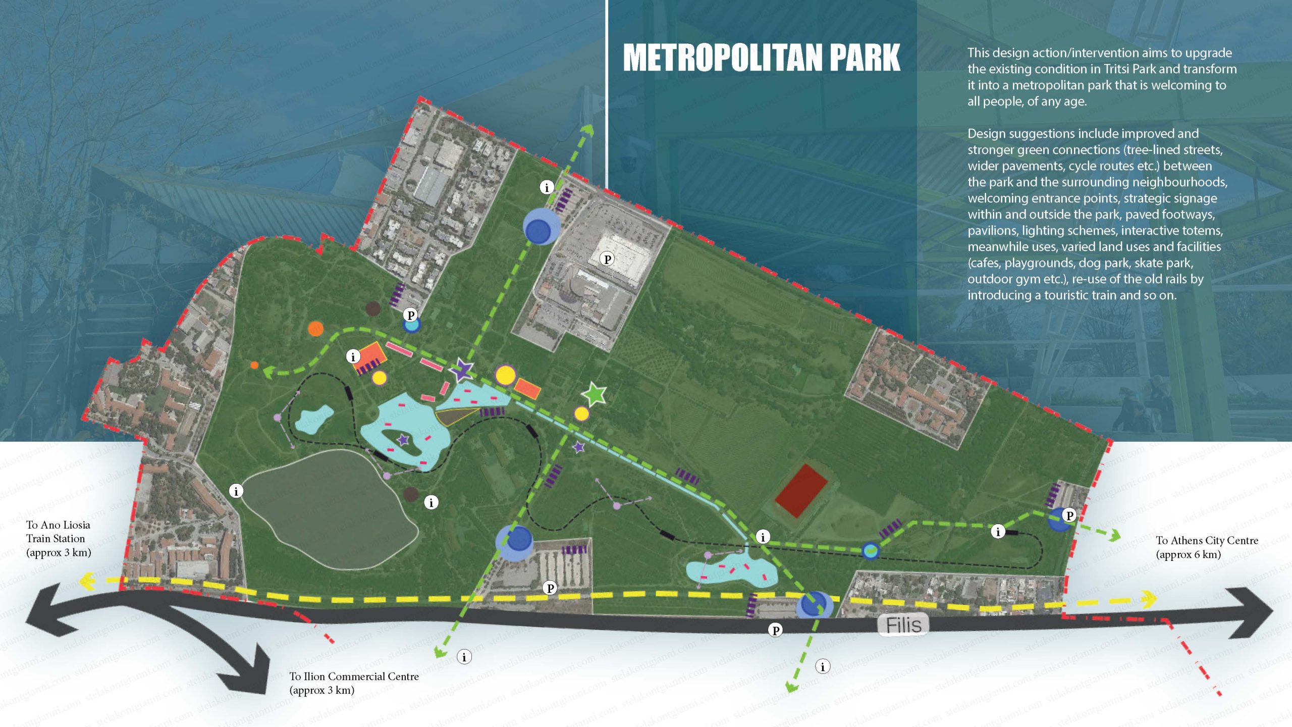
- Spatial Framework. The spatial framework represents the spatial vision for Ilion and the aspiration to make this suburb a great place to live, work, play, shop and grow. It is a constantly evolving framework which allows for flexibility throughout the time. A flexible framework is a successful framework, as it can easily adapt to future economic, political, spatial and cultural changes. Phasing is also part of this flexible framework and the suggested design actions/interventions are categorised in S, M and L, so they can be implemented in steps testing out people’s reactions (either positive or negative). This technique, called urban acupuncture, suggests ‘pinching’ at different places in Ilion, in the form of small interventions, to generate (or not) activity, interest and movement. It is an opportunity for designers to work closely with local people, truly understand their needs and, ultimately, propose a successful design.
The slides below (brochure) offer a quick overview of the material included in the Spatial Framework for Ilion report.
Please reach out to hello@stelakontogianni.com to share your thoughts or if you want to have access to the full report.