The spatial dynamics, planning background and many contrasts of San Francisco
First trip to the United States. Destination San Francisco. An enlightening experience, overall, but overwhelming nevertheless. Many things to comment on, from an urban design perspective, both good and bad, hence this blog post. Before, however, getting to the juicy part, a quick overview of the city planning history of San Francisco, from the early years of its creation till today, will be preceded to set the background and thus, underpin any criticism on the existing urban condition. Other parameters, equally important, for instance economic, social, political and cultural changes, may also be mentioned but not further analysed, as this goes beyond the scope of this blog post.
History of city planning from the early years till today
The first signs of any physical organisation of the land are traced back in 1776, when the first European, Spanish colonial settlers established a rigid three-part structure divided between the military, the church and the people. The natural landscape of the area played an important role in defining these zones back then, and it still influences decisions today.
City plans, in a more formal sense, came later when the city started to grow; Vioget’s plan (1847); an updated version of it by Jasper O’Farrell some years after; and Burnham’s plan (1905). The latter also marked a new era for San Francisco, inspired by the City Beautiful architectural movement aiming to create order and aesthetically pleasing urban spaces for people by suggesting grand tree-lined boulevards, a system of green spaces, establishing the city’s hilltops as key visual markets, as well as imitating the classical style of Greece and Rome. Unfortunately, the plan was never realised due to the catastrophic earthquake and fire of 1906 that led the city to continue with the prior city plans, however, some parts of it became reality like today’s Civic Centre neighbourhood.
The years after the Depression and war brought the City Beautiful movement back again through the promotion of more liberal and modern ideas about the city’s development supporting monumental-scale transformations. This new era also led to two milestones; the establishment of an official Planning Department in 1942 and the creation of the first General Plan which was designed to be a flexible planning document aiming to guide future development in the city.
The years that followed after, in the 1960s and 70s, did not share the same passion about the modernist/functionalist ideas as the years before, but a more conservative approach and thinking was adopted. It is no coincidence that around the same period many concerns were raised, by neighbourhood activists, about the potential loss of the city’s heritage and attractive features in light of modern transformations. As a result of this, the General Plan was rewritten to reestablish the vision and actions around the downtown aiming, this time, to a more conservative approach. In other words, any ideas about the spread of the freeways, massive developments or high-rise buildings were considered too modernistic and non-sensitive to the surrounding context. Today, the General Plan is both a strategic and long term document, broad in scope and specific in nature and it is the embodiment of the community’s vision for the future of San Francisco.
These strong views, from the part of the community as well as the government, towards the preservation of the landscape and urban fabric led to the creation of the Urban Design component, an appendix to the General Plan. It was considered to be a groundbreaking tool, for its time, with San Francisco being the first city in the U.S. to pass a comprehensive set of urban design rules leading the way to urban and city planning. In addition to this, the Downtown Plan (1985) was created to offer more focus on this specific neighbourhood and help control growth, density, heights and preserve sunlight and the Better Neighbourhoods Program (1999) came to add guidance on developments within the neighbourhoods focusing on the quality of the streetscape, open spaces, zoning controls etc.
My observations – current challenges in the city
‘’San Francisco is a special place’’ as stated in the General Plan. To this, I would add, it is also an authentic place. It is the finance capital of the West and a magnet for business, whilst at the same time its dramatic physical beauty, proximity to natural assets, the ocean views, silvery fog, compactness, and cultural diversity, make it an ideal destination for every taste. However, there is always the other side of the coin and unfortunately this one does not look good. Some of my personal observations, based on my site visit to the city and desktop analysis, are presented below in themes:
A cold welcome – Bay Area Rapid Transit (BART)
It is said that a traveler’s experience of a place starts when he lands at the airport and continues long after. The way one feels about a place is a result of moments that he collected during his stay. Every moment is important as it shapes one’s experience of the entire journey.
If this is all true, then San Francisco and the Bay area need to have a serious rethink about the BART system, since it is the main public transport available for airport transfers. SFO’s arrival point feels like a pleasant buffer for what comes next. The stairs leading to the upper floor, where BART trains await, take you to a different world where you see the ugly truth. Old booths and ticket machines, fare gates that look half broken, no clear signage, very little staff to assist you and very antiquated carriages. This unwelcoming condition combined with the fact that, as per recent surveys and polls, BART is not considered a safe means of transport, disencourage people from using it. Instead, a good percentage opts for the Uber alternative, since the city centre is only 40 min away. In addition to this, the large drop in commuters after COVID-19, the large number of businesses leaving the area or completely ceasing trading, the increasing crime rates and number of homeless people, as well as the growing drug problem, all had a ripple effect on the negative branding for BART. Negative branding automatically translates into decreased travelers and eventually, higher probability for antisocial behaviours. It is such an irony that people are afraid to use the public transport in one of the most liberal places in the country.
BART needs new branding which will come with increased staff and security, even new uniforms for staff, better signage, enhanced lighting, improved equipment (booths, ticket machines, fare gates etc.), ticket offers and discounts, surveillance and other cost effective measures, before going for a total upgrade of the carriages. The perception of safety needs to be enhanced and these ”low key” interventions could potentially have great results. It is often, if not always, the surroundings that improve the way people experience a place. Take New York’s and LA’s subways for example, which scored more points in terms of safety compared to the BART, even if statistics show higher crime rates.
This comes to say that the answer to the problem is more complex than just tackling the high crime rates. Increasing security will not create a more welcoming place, if the rest of the surroundings remain the same. The problem needs to be attacked holistically, taking everything into account. From the smaller details (small wins like renewing the logo and staff uniforms) to the greater image (long term schemes like improving the stations, carriages etc.). Only then, does a place feel welcoming, attracts people, brings activity and thus, disencourage antisocial behaviours. On the bright side, a large scheme of upgrades is currently on its way aiming to make BART better, safer and more useful for Bay Area residents for the years to come. You can find more information here. https://www.bart.gov/about/projects
From THE place to a NO place – a ‘deserted’ downtown
When thinking about downtowns, one automatically pictures high rise buildings, active ground floors, traffic and high concentration of people walking around for a multitude of reasons (e.g. going to work, having lunch or dinner, grabbing coffee, meeting friends or travelling home). In other words, one pictures life. However, the post-COVID-19 period has been challenging for many cities across the world and many of them have not yet managed to bounce back. Unfortunately, San Francisco is one of these cities.
2023. Sometime in mid May. Friday afternoon. Downtown in San Francisco. You see nothing but dead streets. It is a fact that San Francisco is facing its highest office vacancy rate since 1993. Commercial real estate firm, CBRE, said in a recent report that 27.1 million square feet of a total 90 million square feet is currently vacant. COVID-19 has clearly hit the city and it has hit hard. However, COVID-19 and the tech crash are not the only ones to blame for this situation. A deeper analysis is needed to get to the gist of it. These events did cause some serious issues, but in reality they only revealed the true weaknesses of the downtown. More specifically, it was betting almost exclusively on just one sector, and similarly to financial investing, a non-diversified portfolio is a bad recipe for when things start going south.
A resilient downtown offers a good range of uses to maintain movement and activity for most part of the day. In principle, people need to have a reason to visit a place. This reason cannot only be work related, but more components need to be thrown into the mix including housing, art, culture, entertainment and leisure. These components will start generating interest along the streets and, consequently, movement. Movement will generate flows within the downtown itself which will, eventually, transform the downtown from a standalone feature to an integrated neighbourhood within the city fabric. After all, adding housing would not only help tackle the empty office problem, but also accelerate the steps towards addressing the housing demand that the city desperately fails to meet.
In fact, there are many examples of successful business centres around the world that San Francisco could draw some inspiration from. Take the City of London for example which constitutes, alongside Canary Wharf, the primary central business district of London. What makes the City successful is that it has become a destination in itself as well as a pass-through to other destinations. On a weekday, you will see people going to or leaving work, cyclists, tourists visiting attractions, locals shopping from the food/fruit markets, young people visiting cultural centers and other hubs, or people walking, having drinks, lunch or dinner. Overall, the City, although still a business centre, is also so much more, whilst its proximity to tourist attractions and important destinations creates a good level of activity on the streets even during weekends.
San Francisco needs to follow a similar path. Its proximity to the waterfront and other important destinations, the potential availability of land for housing, the landmark buildings, breathtaking landscape and compactness are some characteristics that, if combined in an effective way, can make a great recipe for success and ultimately bring life to the streets.
A long stretch full of missed opportunities – a fragmented waterfront
Waterfronts, in general, offer amazing opportunities for activities by, as well as on, the water. This, however, had not always been the case since in the past, the waterfronts had an operational use only. The concept of implementing leisure and recreational uses, in port hubs, along the water came long after. Port facilities used to take up the entire front leaving no room for other uses. It was strictly business.
In recent years though, a new trend has emerged where a coexistence between operations and leisure is promoted. Operational zones have been decreasing their capacity, to adjust to the new standards, and introducing opportunities for mixed uses. This new trend however, has not come without challenges. Questions like ”how do you mix up uses without undermining security and operations?”, ”how do you deal with the vastness of the area?”, ”how do you choose the right land uses” or ”how do you keep the interest going along the entire waterfront?” have emerged as well.
San Francisco’s waterfront is the best case study of the aforementioned challenges. San Francisco began and has developed as a maritime city. Historically, the city offered great natural advantages as a port. Maritime activity stimulated the development of San Francisco as a commercial center of the West Coast and contributed as much to the special flavor of San Francisco. The advent of rail, highway travel, air transportation and telecommunications have, however, increasingly lessened San Francisco’s dependence on water-related activity. Other Bay ports have matured and San Francisco has lost its preeminence as a port city, and much of its waterfront is underutilized.
The city seems to have realised that and it has taken many steps towards repurposing some parts of the waterfront to give way to other opportunities, whilst encouraging maritime activity and boosting visitor activity and resident recreation. A number of other uses have been added over the years, for instance Maritime garden, Pier 39, the new Cruise ship terminal (Pier 27), the Exploratorium (Pier 17), the recently created ”historic walks” (Pier 1.5) are some of these positive interventions. These clearly attract people, both locals and tourists, throughout the day.
Although very positive steps in the right direction, these interventions currently work in the same way as American high streets. They attract people, create activity in their cores, but there is no flow between neighbourhoods. There is no movement in between places and there is no interest in exploring anything beyond the high street. Unfortunately, a similar condition can be observed along the waterfront too. There are parts of it that work better than others, due to the proximity to landmarks and other interesting nodes, but overall the walk along the waterfront feels boring. A strong flow of people has not been established yet, making the whole walk feel fragmented. The lack of clear signage, or consistent signage along the waterfront, the continuous low levels of enclosure, the vastness of the area and the large inactive areas in between landmark places, make the whole walk feel so long, especially in the heat.
Overall, what is really missing right now is a meaningful connection with the city. The waterfront should not be treated as a standalone feature, but as a piece of the city. Its great extent can create amazing routes from Golden Gate to Hunters Point and into the city. It can offer splendid views towards the sea, but also towards the city itself, the hills, attractions, new developments, an improved landscaped and public realm and so much more. Views that will create a constant interest along the waterfront and make people feel it’s worth walking. Lastly, rising sea levels can also give the opportunity for more landscape schemes along the waterfront, similar to Crane Cove park. These interventions not only have an ecological contribution, but also improve the surroundings and draw people in. It is a win-win situation.
As a final point, I would say the waterfront needs to reclaim its past status, but with a modern twist. In other words, it needs to truly and wholeheartedly integrate with the city by reclaiming its past maritime status and welcoming a variety of other uses on board. Only then it will become a destination in its own right.
Walking challenge – the city of 1000 hills
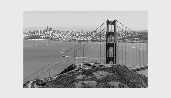
1000 might be an exaggeration, but there are more than 40 named peaks in the city creating this unique landscape, outstanding views towards the sea and the city and breathtaking perspectives along the streetscape. Interestingly enough, the grid system imposed by the early settlers took advantage of these views by designing a simple grid having streets ending at the hills, instead of streets winding themselves around the hills. Anything said about San Francisco’s landscape is an understatement and it can only be fully experienced when one walks along these streets.
However, there is a price to pay to experience this beauty and, in fact, it is quite big. The pedestrian experience in the city feels fragmented and topography is one of the reasons. Distances that would otherwise be short, in reality, feel longer as they often require some ascending and descending. Viewpoints towards landmarks that would otherwise visually lead the pedestrian flows, are often blocked by the hills. Overall, it seems that topography is a hard boundary disencouraging movement and activity.
However, there are other parts in the city that enjoy the benefits offered by the hills, for instance, Mission Dolores Park, Lombard Street, Coit Tower or Francisco Park. These hills have been branded as destinations and attract locals and tourists. Essentially, the main difference between these hills and Hill Street for instance, is that the first ones have been promoted on social media or via strategic signage within the city raising public awareness. That, combined with the fact that the old tram line passes across some key hilly streets encourages people to visit these places even more compared to others.
Overall, it is about either improving the experience along the hilly streets or creating visual connections to destinations through hilly streets that could make people think less about the hill and its disadvantages and encourage them to walk. The steps from Coit Ter towards Coit Tower is a great example of an amazing experience along the way as the route passes through a picturesque neighbourhood of old houses with well kept gardens and rich flowerbeds welcoming you to take a moment to smell the flowers and take in the sea views while ascending. When the walks become interesting, they invite people to slow down, pause and appreciate the surroundings. Once the senses are distracted, the mind will not complain about the physical setbacks along the way.
Diverse neighbourhoods with distinct boundaries
There is a great mix of characters in the city and each neighbourhood offers a distinct vibe for literally every taste. They all follow a similar layout, except from the downtown, with the high street in the middle, the beating heart, and residential all around. These beating hearts are very vibrant, some more than others, and they attract activity throughout the day.
What happens, however, in between these beating hearts is a matter of concern. Unfortunately, nothing happens. The distance from one neighbourhood centre to another might not be too long, geographically speaking, but it certainly feels like it is. It almost feels like time stops, if you try walking from one centre to another. The hills, the long stretches of residential areas and lack of mixed uses, combined with the high concentration of homeless people in some areas, disencourage people from walking. As a result, any walk between neighbourhoods is purely practical, taking people from point A to point B. Strolling around is not really an option, since the main activity hub is the high street. For a stroll to occur, a flow must be generated which links different points of interest between them and thus, drives people.
Although, there is no evident flow within the neighbourhoods, there are two identified in other parts of the city, both created by natural elements. The first one, the green flow, is generated through a system of parks, of different character and scale, starting from within the city (east) and moving towards the west up to Ocean beach. The second, the blue flow, is generated along the waterfront, stretching from the Golden Gate all the way to Hunter’s Point to the south. Both flows are not in perfect condition, however, they establish a positive precedent for the city.
What is missing now is the interaction between these almost established flows and the rest of the city fabric. This could be achieved through the creation of secondary flows starting from the neighbourhoods and connecting with those main flows. Those secondary flows could host a mix of uses, installations, landmarks, outdoor markets, car-free zones and other features or events that attract pedestrian movement. Once these are connected, they will generate a strong network of flows with the city that will encourage walking, more than before, and strengthen the vision for a compact city.
Eco-friendly, but underused, public transport
MUNI system is a network of fuel-efficient buses, light rail metro trains, streetcars and cable cars that cover the entire city. They are affordable, and in fact free for people under 18 and over 65, and in a better condition compared to BART. In addition to this, paying using Clipper is very convenient since other than a physical card you can also set it up contactless in your phone. In other words, it is eco-friendly, diverse, and smart…but it is also fragmented and underused.
A quick glance at the MUNI map gives the impression of a well connected network, due to the variety of lines running through the streets. In reality though, the network is only convenient if one has to take a direct line to the destination. If the journey includes changing lines or switching from one means to another, then it gets more complicated and less pleasant/quick/convinient for the user. The complication appears due to the low frequency of services, minimal overlapping between different means of transport and lines and lack of smart stops to indicate time schedules. Overall, it feels as if each travel line was created in isolation from the rest and with no intention to accommodate complex journeys.
Moving forward, the MUNI network needs to level up its game if it wants to attract more people, by promoting its eco-friendly agenda, improving signage and information of time schedules and rethinking the travel routes for all means of transport, starting with buses.
San Francisco’s big seismic gamble
It’s not news that the city sits on top of the San Andreas fault, nor that it has already experienced quite violent shaking back in 1906. It’s also not news that the city is built on landfill; fill is built on top of bay mud or soft ground and thus, runs the risk of ground failure or liquefaction during an earthquake. None of the above was concerning, till 2009, when Millenium Tower started sinking and tilting.
This event gave rise to a number of voices stressing the city’s big seismic gamble and trying to put a stop to the uncontrolled proliferation of high-rise buildings downtown. In fact, at least 100 buildings taller than 240 feet were built in areas that have a very high probability of liquefaction. This comes as a surprise when thinking of the city’s prior strong opposition to high density developments, and Manhattanification of the downtown area. However, since 2004 onwards, a new plan was put in motion aiming to redevelop and brand it as a strong hub for business. This was translated, as we have seen in other cities across the world too, into a mushrooming collection of high rise buildings, signalling the beginning of a new era for the city. These buildings, though, are also a potential danger for the city since they sit on unstable, earthquake prone, ground.
What currently drives the push to change codes and reinforce safety and stability of these buildings is the notion that California has so much more to lose than it did in 1906. The billions of dollars of infrastructure, headquarters of global industries and the denser, more vertical downtown make San Francisco a much more interconnected and vulnerable place. The new codes that will come forward will aim to strengthen the city, the water systems, electrical grids and cellular networks, not just individual buildings.
Summing up, all the above observations affect people’s daily life in San Francisco, as well as a visitor’s experience of the place. In a way, all those create a number of contrasts for the city:
It is a liberal city, but people are afraid to take the subway;
It is a compact city, but people are disencouraged to walk or cycle;
It is a ‘green’ city, but the green networks are not well established.
It is a city by the sea, but the waterfront feels fragmented.
Those contrasts give mixed messages and thus, create confusion between the vision for the city and the everyday reality.
What is there now and what is missing?
Currently, the tool that the city has in its possession to address this kind of concerns and shape the city overall and, in a way, the vision too, is the General Plan which is composed of 10 components, including the Urban Design component, the Land Use Index and the Area Plans.
On the positive side, these are groundbreaking documents including an in-depth analysis and design development organised into objectives, implementing policies and principles. These elements aim to provide guidance for future development in the city outlining the vision for the physical future of San Francisco. They very clearly describe the key characteristics that make the city what it is and any design decision should be fully aligned with them. The need for the creation of these documents and thus, for a clear definition of the character of the city, derived from the ongoing pressure that the physical environment was under, with much of the residential area of the city built out, the upcoming significant expansions of the downtown and the economy undergoing transformation.
The Urban Design component that came after, also tried to establish a definition for urban design promoting it as not merely a means for aesthetically improving a place, but also an important tool to improve the quality of people’s lives. Urban design was promoted as a tool to control future development, preserve the physical beauty of the place and retain its key characteristics. Overall, the General Plan was seen as a visionary document for its time and surely a breakthrough in the urban design field. However, when reading these documents today, they surely do not read as visionary anymore.
In reality, they have a static character, rather than being used as a visionary too to plan for the future. It is a fact that they have influenced the city mainly in what they have prevented and less in what they have promoted and enabled. The General Plan is not being used to shape the city, to promote growth or create a sustainable environment to anticipate future changes. Essentially, it is not a catalyst for future growth, but a means to block any unwelcoming initiative. The vision that the plan is promoting, does not resonate anymore with modern times. The city’s profound fear for change is clearly illustrated within the General Plan and threatens San Francisco with stagnation.
The issues that the city faces are complex and range far beyond simple questions of massing and scale. These new challenges call for new tools. There is a need for a new element that is strategic in nature. An element that takes on board all these key characteristics and qualities of the city, beautifully laid out within the General Plan, and creates a strong vision for the future. A long-term vision that reflects on all these things, but at the same time plans ahead with no fear for change. A vision that prioritises flexibility not fixation, the quality of life, climate changes and sustainability and a strong place-branding for the entire city.
This vision, which could have the form of a high-level framework for the city, must sit on top of the General Plan, acting as the glue that brings all of its components together towards one direction. This vision could be the new guiding light for the city of San Francisco.
Useful links:
- https://www.bart.gov/about/projects
- https://www.foundsf.org/index.php?title=Burnham_Plan_1905#:~:text=Burnham%27s%20plan%20gave%20extensive%20treatment,said%20little%20about%20planning%20housing
- https://sf.curbed.com/2013/1/2/10290178/daniel-burnhams-san-francisco-plan
- https://www.spur.org/publications/urbanist-article/2006-07-01/imagined-city-burnhams-vision
- https://generalplan.sfplanning.org/index.htm#footnotes
- https://sfurbanplanning.weebly.com/the-san-francisco-general-plan.html
- https://generalplan.sfplanning.org/I5_Urban_Design.htm
- https://localwiki.org/sf/Urban_Design_Plan
- https://www.udg.org.uk/publications/articles/san-francisco-plan
- https://www.spur.org/publications/urbanist-article/1999-08-01/san-francisco-urban-design-element
- https://generalplan.sfplanning.org/introduction.htm
- https://www.bart.gov/news/articles/2020/news20200526
- https://bayareapunk.com/blog/transit-crime.html
- https://www.kqed.org/news/11799297/large-parts-of-the-bay-area-are-built-on-fill-why-and-where
- https://www.nytimes.com/interactive/2018/04/17/us/san-francisco-earthquake-seismic-gamble.html