Feasibility study and masterplanning proposal for the expansion of a university campus, Scotland
GENERAL INFORMATION
- Location: Craibstone, Aberdeen, Scotland
- Professional work | AECOM | 2020
- Publication of the project: https://www.pressandjournal.co.uk/fp/business/farming/2728150/sruc-launches-consultation-on-craibstone-campus-expansion-plans/
GENERAL CONTEXT
High level study aiming to provide guidance and advice on the expansion of a university campus in Craibstone, Aberdeen. This study included a review of the spatial options available and a more specific piece of advice in relation to some key facilities.
DESIGN PROCESS
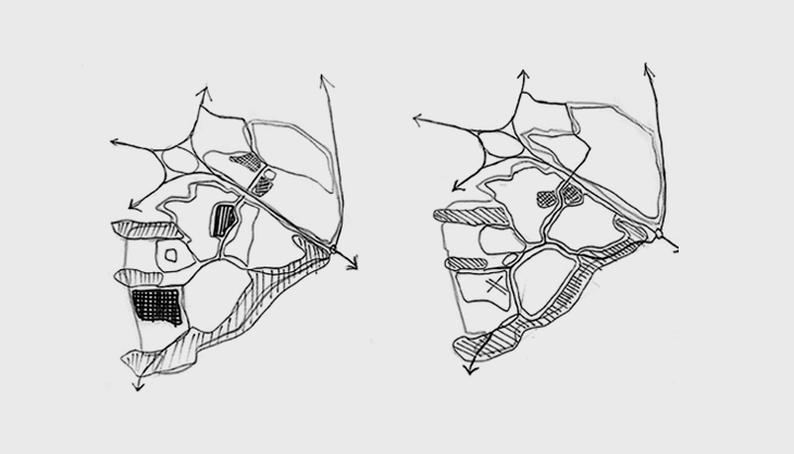
Visiting the site and collecting photographic material is the first step to better understand the study area, the existing elements and landscape. A workshop followed shortly after to discuss key issues for example the context of the study, precedents of similar projects elsewhere and the potential masterplanning options for the site with the key stakeholders. The aim was to identify the key issues, opportunities and constraints of the site and to map people’s views and preferences via some engaging exercises.
The proposed masterplanning options took into account the spatial requirements for each facility and the types of study rooms and areas needed. The main principles on which the layout was based were:
- Creating good connectivity with the main existing buildings and the road network to facilitate movement for the students but also for the animal transfers;
- Securing plenty of open space next to buildings where handling of large animals would be necessary;
- Preserving the topography, hilly landscape;
- Enhancing the social character of the university by creating social space for students;
- Mitigating areas of potential flooding and protecting the existing woodland;
- Enhancing branding and creating a strong frontage along the main road.
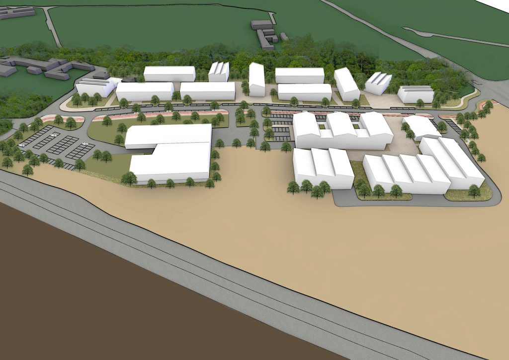
The second phase of this exercise was to produce an illustrative masterplan based on the high-level analysis and proposed land uses in phase one. The second phase aimed to define the layout of each facility and their relationship with the public realm in order to improve students’ experience in the campus. Issues like the hilly landscape, the lack of social hubs, the existing highway splitting the campus in two sides were creating a hostile and unsafe environment for the people in the campus.
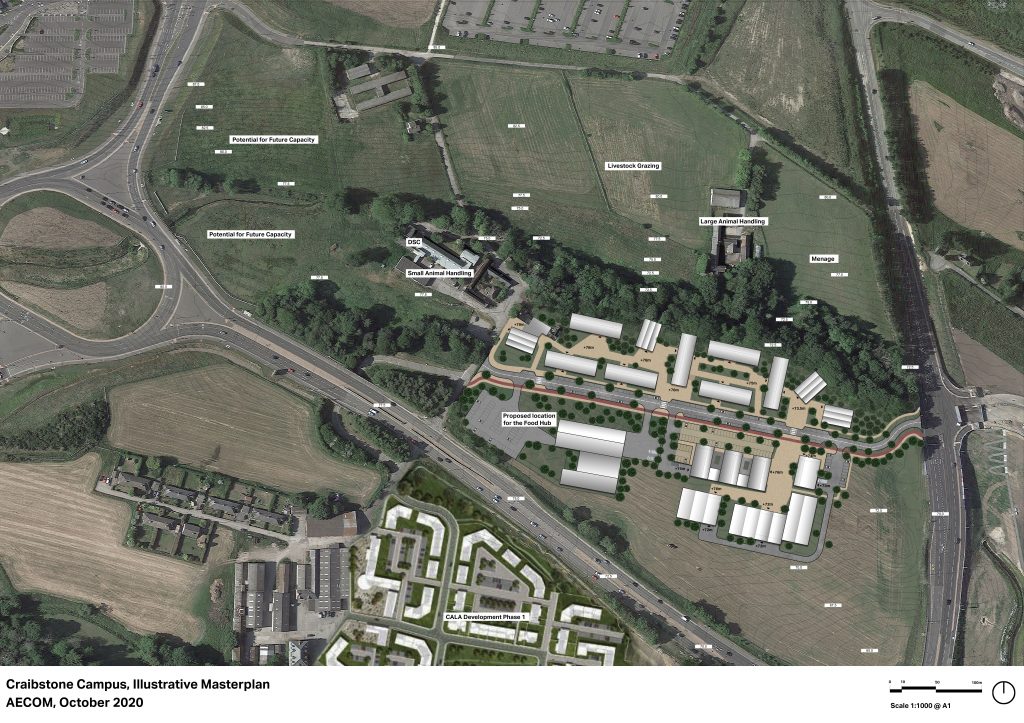
The proposed plan would aim to cluster most of the facilities in order to keep the majority of students in one place rather than spreading them all around the campus. The social hub, the new heart of the site, would be located between the student halls and the university buildings so as to create a vibrant and safe environment. Some other building facilities that are required to be next to open land for animal handling issues would be accommodated in the existing buildings around the site where there is plenty of open land. Cycle and pedestrian paths would improve connectivity and establish an alternative, eco-friendly, means of transportation. The challenging topography would be taken into account in shaping the forms of the university buildings, the public realm, the open spaces and the service yards.
PERSONAL CONTRIBUTION AND THOUGHTS
This masterplanning exercise was a combination of a high-level framework study with a more detailed masterplan as a second phase. For that reason, the initial focus was on the spatial analysis to understand the constraints of the site and later, on calculations to evaluate ways to meet the spatial requirements for each facility in the site. My role included analysis of the site, research on precedents of other universities, preparation of the graphic material for the workshop, research on spatial requirements for each facility, experimentation on possible layouts for the masterplan and the final production of the illustrative piece.
Overall, working on this project helped me:
- expand my work experience in the educational field and gain knowledge on general design principles for university campuses and more specifically on veterinary universities;
- practice on spatial calculations and layout options;
- develop my thinking around the relationship between building complexes, especially on a hilly landscape and the surrounding environment; and
- develop my skills when designing for the public realm and its elements (cycle lanes, pedestrian paths, parking spaces, open spaces, turning points etc.).