Is Canary Wharf more than merely a place to work?
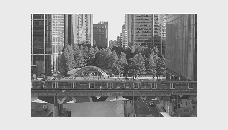
Canary Wharf is a place of huge debates. The old Docklands area, transformed into a modern financial centre of high-rise buildings, is one of the largest regeneration schemes in Europe. It is advertised as a place of high quality where one can work and live, whilst at the same time it also receives negative feedback by a good number of people, mainly those living in the surrounding communities. This regeneration has shifted the balance affecting the surrounding areas (Poplar, Blackwall, Millwall and Cubitt Town) and it has created friction between new and old communities.
This blog post will evaluate the area under a set of design principles, while also taking into account the historic context as well as the vision, objectives and planning policies set by the Local Plan. The aim is to better understand the existing condition, the level of alignment between vision, objectives and design outcomes and finally identify any design errors.
HISTORIC EVOLUTION & REGENERATION OF THE DOCKLANDS
Where Canary Wharf is located today, it used to be the Old Docklands. The evolution of the docklands goes a long way back to the roman and mediaeval times, when the existing facilities provided for the ships were inadequate. In particular, the ships arriving in Thames River tended to dock at small quays in an area known as Pool of London which seemed to provide no real protection from potential thieves and limited space at the quayside. For that reason, Howland Great dock was built (1696) and later on, due to its commercial success, more docks were created during the Georgian and Victorian eras; West India (1802), London (1805), East India (1805), Surrey (1807), Regents Canal dock (1820), St Katherine (1828), West India South (1829) and Victorian docks (East, Royal Victoria, Millwall, Royal Albert). In terms of management, the docks were built and managed by a number of private companies which, in 1909, were amalgamated under the Port of London Authority (PLA) aiming to improve labour relations and facilitate processes.
The first hit occurred after the 2nd World War when the German bombings damaged the docks. However, the docks were rebuilt and thrived till the 1950s. The shift in the thriving period came around 1960-1970 when the shipping industry adopted a new container system of cargo transportation and therefore, larger vessels, which required deeper waters that the existing docks could not provide. As a result, between 1960-1980 all the docks in London were closed which hugely affected deprivation and poverty numbers.
The regeneration of the area was the next natural step; the vacant land in close proximity to the city centre and the rising housing needs in London were two powerful triggers. The general scope was to redevelop the area for office and residential use. The first challenge in the process was the number landowners involved which would potentially slow down the regeneration schedule. For that reason, London Docklands Development Corporation was formed (1981); a statutory body appointed and funded by the central government that also served as a planning authority for the area. The transformation of the area was unprecedented and by 1998 the control was given back to the local authorities.
THE VISION FOR CANARY WHARF
The regeneration aimed to transform Canary Wharf into a financial business centre bringing a shift from the heavy industry, old docklands, to the light industry, the financial sector. The vision for Canary Wharf has been also expressed in Local Plans and policies for Tower Hamlets Borough:
- ‘Reinforce and strengthen Canary Wharf’s role as a global financial business centre, while the City Fringe and Whitechapel are emerging hubs for life sciences, bio-tech and digital industries’; and
- ‘Canary will be a place for mixed, vibrant and resilient commercial, retail and leisure hub’.
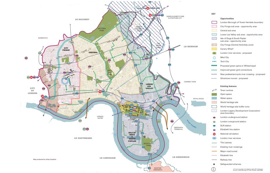
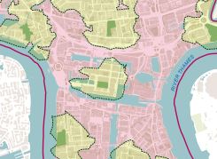
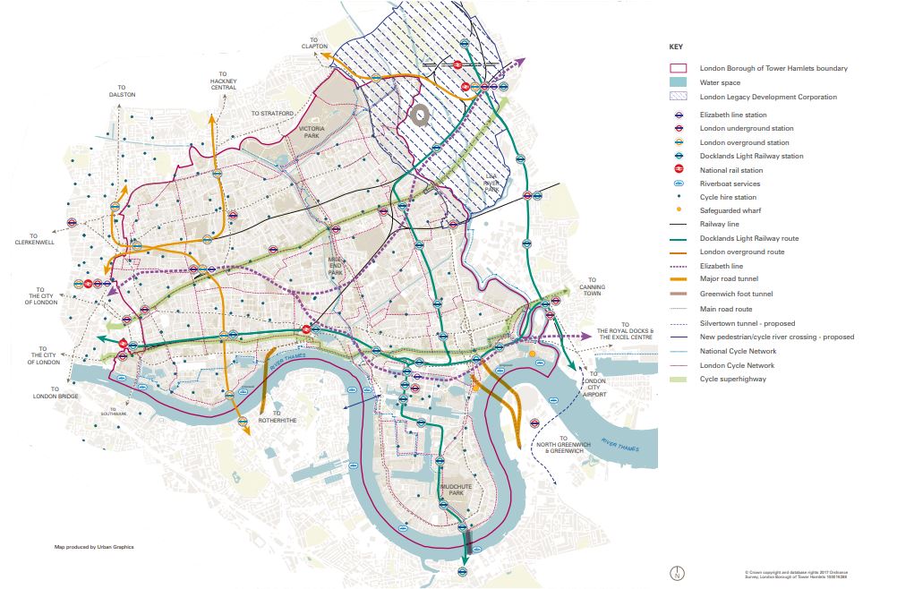
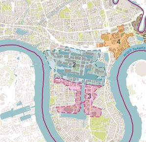
It seems that the vision for Canary Wharf is not only limited to the area boundaries, but expands beyond that to surrounding areas, as shown in Figure 01. Thus, the belief that Canary Wharf was created to compete with The City is not valid anymore; it looks more like a healthy cooperation and communication between the two centres than anything else. Canary Wharf is taking more and more the character of a financial business centre, whilst The City is gradually transforming into something different. It is all part of a high-level strategy where each element has a unique character and contributes to the overall place-branding of the city. For that reason, Canary Wharf should be criticised based on urban design grounds rather than just being compared to The City. Elements like street network, legibility, public realm, frontages, building heights, sense of place, sense of community and safety will be looked at in this blog post to provide an understanding of the area.
HIGH LEVEL STRATEGIES FOR CANARY WHARF
Tower Hamlets Local Plan 2031 identifies sub-areas within the borough, each one attached with a set of policies; Canary Wharf belongs in the Sub-Area 4: Isle of Dogs & South Poplar. This area includes a collection of vibrant and distinctive town centres, employment hubs, transport interchanges and residential areas. Apart from Canary Wharf, the sub-area 4 comprises 5 other distinct character places with Blackwall, Cubitt Town and Millwall being adjacent to Canary Wharf. More specifically about Canary Wharf, there are a set of strategies which have an immediate impact on the area itself, as well as in its surroundings. These strategies are mentioned below and in figure 02:
- There are sites allocated for mixed use development; 3 within the Canary Wharf area and 10 more within the Isle of Dogs;
- Waterfront route improvements within Canary Wharf to improve the environment and promote walking and cycling;
- Green grid connection improvements to make Canary Wharf more accessible to its surroundings;
- New river crossings to mitigate the impact of canals in permeability;
- More pedestrian footbridges to improve connectivity over water;
- Road improvements; and
- Station link improvements.
Overall, these strategies aim to make Canary Wharf more accessible to the surrounding areas, improve the quality of the area and allow for more opportunities for entertainment, walking, gathering, resting and art, apart from work. As a first comment, these strategies are aligned with the general vision for the area and this is a first positive sign of a well-communicated high-level plan with the design decisions and tools.
URBAN EVALUATION OF CANARY WHARF
The urban evaluation will analyse the area in more depth aiming to identify gaps and possibly provide some additional suggestions to the above design strategies.
Permeability & street network. Permeability for all means of transport is an important principle. It enables flow and movement and it also eliminates obstacles. A well-connected and permeable network improves movement and legibility.
Relevant policies in the Local Plan: D.SG4 Planning and construction of new development & D.DH2 Attractive streets, spaces & public realm.
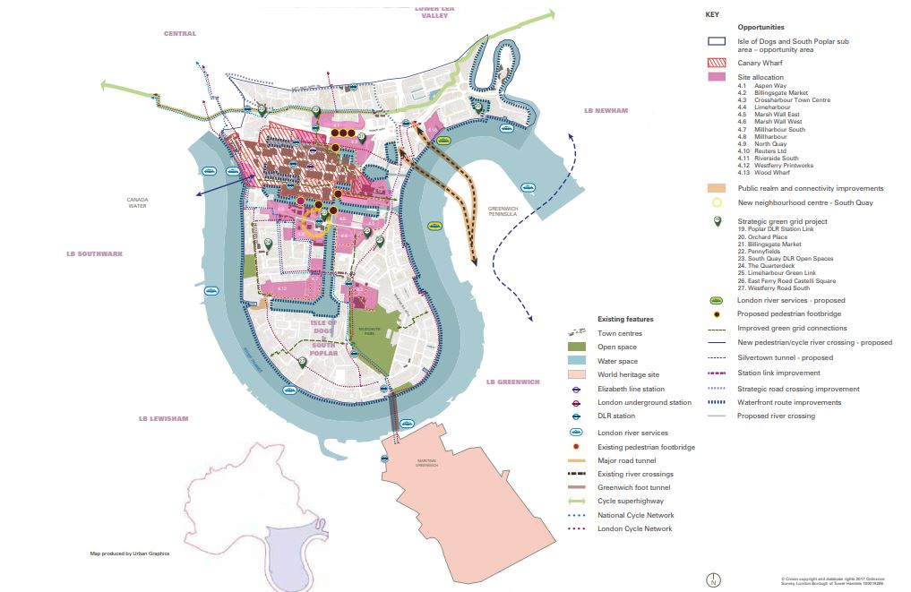
On-site evaluation: There are some physical features in the area that hinder permeability; railway to the north separates Canary Wharf with Poplar, and the docks (water feature) isolates the area from the north, east and south. These two can potentially act as barriers if not properly treated. In addition, another issue within the study area is the number of construction sites that are responsible for many road cut-offs. This creates confusion to the people, either drivers, cyclists or pedestrians. However, in terms of street network the roads are permeable and there are no cul-de-sacs which is positive, because the former facilitates vehicular movement and driver’s perception of a place and encourages pedestrian flow.
Pedestrian movement is not only facilitated by the street network, but also by the pedestrian connections in the area. In particular, pedestrian paths, crossings and bridges can be found throughout Canary Wharf creating connections over the water, the docks, as well as perpendicular links and cut-throughs between roads. As a general feeling, the area coverage for pedestrian movement exceeds the area for vehicular movement.
Canary Wharf is a place where some of the existing physical features, if not turned into opportunities, can become highly negative constraints for the area itself and the surrounding neighbourhoods. The challenge on permeability is less focused on the cars and more on the pedestrian flow. The need for improved and new links across and over water is undeniable and also highlighted in the Local Plan (2031). In particular, relevant proposals, shown in figure 02, include pedestrian links, waterfront public improvements and green links to improve pedestrian flow and connect with northern neighbourhoods and existing open green spaces within the area.
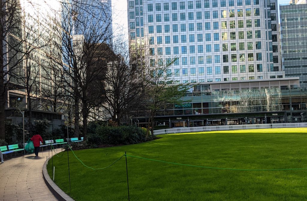
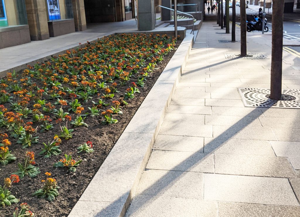
Green & blue infrastructure. Green and blue features are important in an area to enhance the existing environment and improve quality of life; being closer to any form of nature can only bring positive results to people’s life.
Relevant policies in the Local Plan: D.DH2 Attractive streets, spaces & public realm, S.OWS1 Creating a network of open spaces, D.OWS3 Open space and green grid networks, S.OWS2 Enhancing the network of water spaces & D.OWS4 Water spaces.
On-site evaluation: As shown in figure 04 below and also confirmed during my personal site visit, there is a good coverage of open and green spaces and water features in the area. In particular, all these elements, shown in dark green, are within walking distance (light green filling, less than 400m) from any part of Canary Wharf.
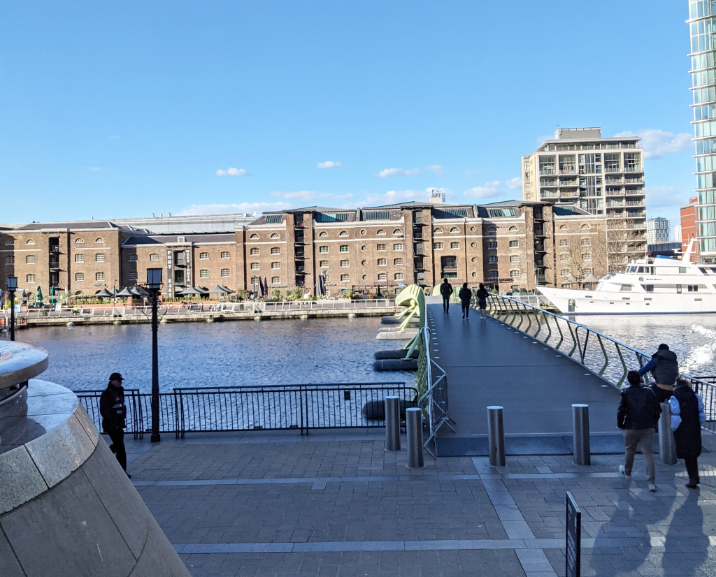
Another important characteristic is the variety of types and scales of these green elements which breaks the monotony and adds to the green character of Canary Wharf. There is Jubilee Park next to the metro station where the rich vegetation, the large trees and the artificial running water creates a place for relaxation, social intercourses and lunch breaks away from any visual contact with vehicles; Canada and Montgomery Square, the first greener than the latter, but both equipped with large trees, offer space for social activities and gathering; north Dock semi-indoor space is a home for rich vegetation and a variety of plant species including paths and seating areas as well; Cabot square, decorated with a central fountain and seating areas, offers long-distance views to different destinations, as well as some shaded seating areas on a lower level; recently built open space at 10 bank Street offers vast areas for golf, exercise and other group sportif activities; Westferry Circus, equipped with large trees and vegetation, offers some seating areas, but it is mainly visited for the 180 degrees view to the City that it offers; Columbus Courtyard, a hidden small square equipped with a golf course. On a smaller scale there are also other pocket green places or other green examples of large street trees and flowers along the public realm.

The water is equally present, if not more, in the area and it can be seen and experienced through the canals that surround Canary Wharf, the fountains and other water features. Bridges crossing the canals, benches along the public realm and elevated grounds offer opportunities for views and vistas to the water. In addition, temporary art installations by and on the water create some additional opportunities for interactions.

Although there is a good coverage of green and blue infrastructure within Canary Wharf, the overall experience of the pedestrians/cyclists could be improved through some public realm improvements. Those will encourage people to stop and linger in order to better connect with the water. It is important that the public realm offers recessed spots to give this opportunity to the people. In addition, Tower Hamlets Local Plan has identified areas within Canary Wharf that could be benefited from some public realm improvements, while also proposing some green links to better connect the area with surrounding neighbourhoods.
Gateways & access features. These are important features in a place to signalise entrance, exit points. Gateways can be identified through some corner treatments, landmark buildings, colour techniques etc. This can help navigation and create a more legible environment for the people.
Relevant policies in the Local Plan: D.DH2 Attractive streets, spaces & public realm.
On-site evaluation: The general urban structure of Canary Wharf, being surrounded by water, naturally creates clear gateways. There is no doubt that the roundabout to the west, or the pedestrian bridges to the north, east and south are well defined gateways to the area.
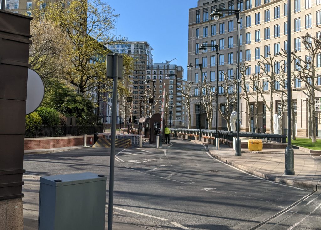
In addition to this, the permeable street network gives the opportunity for long-distance views to the gateways which enhances legibility. Other elements on the public realm, like tress lines, art installations, signage and control points also contribute to a legible environment.
Overall, it is very important to be able to understand a gateway when you see one. It needs to signalise the entrance and exit to an area, transcending from one place to another. However, good levels of legibility not only are needed along the entrance/exit points of an area, but also within the area itself. No matter how clear and well-defined the gateways are, if legibility is poor on the inside then, the overall experience of the place is poor too.
Active frontages & mix of uses. This includes any ground floor use related to cafes, restaurants, bars, shops. In general, active frontages are important to generate movement and activity and encourage flow.
Relevant policies in the Local Plan: D.DH2 Attractive streets, spaces & public realm, D.DH9 Shopfronts, D.TC5 Food, drink, entertainment and the night-time economy & D.TC7 Markets.
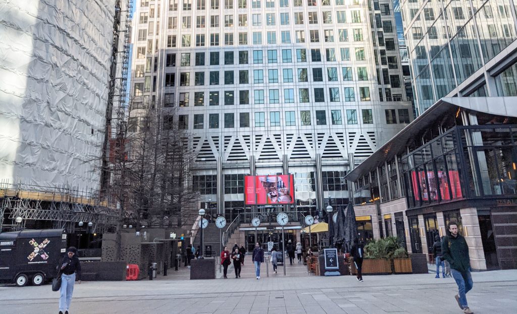
On-site evaluation: What is unique about Canary Wharf is the fact that it offers two levels of activity; one on the ground and another one underground. A large number of retail, shops and restaurants extend to the underground levels offering opportunities for shopping, drinking, eating. On the other hand, the main land uses on the ground floor is office space, since this is the primary character of the area, but there is also a good number of bars, restaurants, cafes and shops.
This configuration of land uses would normally create two movement and activity patterns, one for each level, hindering any possible perpendicular mixing. However, during the day you can spot the exact opposite; people easily moving between the two levels without only choosing one. It is not magic…but, the reason behind this lies in the way that the underground is connected with the ground level; there are many entrance/exit points around the ground floor which helps legibility and gives people the opportunity to choose to go underground at any time. If there were only e.g. 2 entrance/exit points in the whole area that would have separated the movement on each level even more and the changes for interaction between the two levels would have been kept to the minimum.

Alternative means of transport. This includes any means that leaves no carbon footprint like walking and cycling. Sustainable travel is important to improve the living conditions in an area and encourage a greener attitude towards transportation.
Relevant policies in the Local Plan: S.TR1: Sustainable travel & D.TR2: Impacts on the transport network.
On-site evaluation: As already mentioned in the permeable network & active frontages paragraphs, there are wide pavements that facilitate flow and encourage walking, pedestrian bridges that provide connections with surrounding areas and an underground shopping mall that offers the possibility for car-free walks and shopping. All the above, encourage walking in the Canary Wharf area.
In terms of cycling, even though there is no designated cycle route within Canary Wharf, people cycle often. The light presence of cars in the area creates a sense of safety for cyclists, even if there are no officially designated route. In addition, there is also a good cycle network bordering the area to the west that provides connections with many destinations and central London.


Canary Wharf, and the Isle of Dogs in general, is well-serviced by buses. There is a good number of bus stops within Canary Wharf that offer connections with many surrounding areas and central London. A good network of buses eliminates the dependency on cars which has a positive impact on the environment.
Overall, the current conditions in Canary Wharf encourage walking and cycling more than driving. There are many activity nodes along the canals or in the parks and squares that give people the incentive to leave their car at home and start exploring the area on foot. Whoever wants to take a stroll around Canary Wharf can safely choose to do so on foot or a bike without feeling threatened by the cars. Wide pavements, variety of locations for cycle stands and docks and the discrete presence of cars, all contribute to a general feeling of a safe and walkable place.
Public realm. Public realm area ties the open spaces, pavements, street furniture, art installations together. Its quality affects the pedestrian flow and the environment of the street, neighbourhood and area in general.
Relevant policies in the Local Plan: D.DH2 Attractive streets, spaces & public realm.
On-site evaluation: The public realm areas cover a large part in Canary Wharf. Any comment in terms of the width of the pavements has already been covered above, since it is one of the most important principles for a successful public realm. A wider pavement can accommodate more people and facilitate flow. However, apart from that, other principles are also important and contribute to the overall success of the public realm; materials, quality, consistency, street furniture, shelters. The materials and the quality of the public realm and street furniture in Canary Wharf are of high standards and offer a high level of consistency with the general street scene. This creates nice aesthetics and a pleasant environment for people to walk, gather and socialise.
Another element that betters the general environment and walking along the public realm is the discrete presence of cars. Any visual to a large number of cars, either congested or parked, can become unpleasant and give the impression of a car dominated place. In this case, the car parking areas are all underground and there is limited on-street parking. This creates a scene more welcoming to pedestrians and cyclists, as cars and people coexist without one, physically or even visually, threatening the other.
Whilst there are many areas for gathering and sitting in Canary Wharf, there is a lack of shelters and covered areas to offer protection from wind and rain. The weather in Canary Wharf, and London in general, can become very windy and rainy. For that reason, it is important that the existing infrastructure offers routes within the area that can offer some protection for pedestrians, as well as some shelters where people could gather and socialise no matter the weather condition.
Other elements that should decorate the public realm in general are green, public art and wayfinding features. Green elements are very present in the area in the form of street trees, flowers and grass covering a good part of Canary Wharf. In addition, art installations can be found around the area, some permanent and other temporary, demonstrating the work of artists. Wayfinding totems of modern style are located throughout the area to improve legibility; those are varying in type depending on the information they provide; totems to point out directions, interactive totems to provide information for events or maps, or even QR codes that enclose information on location maps, events etc.


Overall, the public realm is in good condition in the area and it is also constantly monitored. The green elements contribute to the good quality of place, whilst art installations and modern and interactive signage enhance the culture and the activity in the area. However, there is room for improvement, also identified in the Local Plan, mainly along the canals in order to improve the sitting areas and encourage more gatherings in the area. In general, there is an intention to boost the social aspect in Canary Wharf and this can only be succeeded if the infrastructure allows people to do so.
Art & culture. Art installations can visually improve the environment, attract people and bring a cultural boost in the area.
Relevant policies in the Local Plan: D.DH2 Attractive streets, spaces & public realm.
On-site evaluation: Every place has a culture which derives from the local people and the history of the area. Art installations and events can help bring this context back into life and create interesting interactive points for the pedestrians along the public realm. There are a number of temporary art installations placed around Canary Wharf showcasing the work of many artists. Some of these installations are interactive, whilst others have the form of sculptures, colour or light installations.
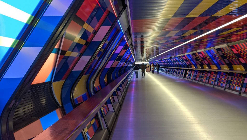

In addition, there is a variety of events taking place on a regular basis in Canary Wharf attracting visitors. An example of these events is the Canary Lights event that takes place every winter; light installations are placed around Canary Wharf lighting up the area in many artistic ways. This initiative attracts many people every year and makes Canary Wharf a destination.

Signage & wayfinding. Signage and wayfinding is important to improve legibility and navigate people around an area. A successful wayfinding system not only includes sign posts and totems, but also other elements in the urban fabric like landmark buildings, open spaces, street network, art installations. These play an important role in helping people memorise places and streets.
Relevant policies in the Local Plan: D.DH2 Attractive streets, spaces & public realm & D.DH10 Advertisements, hoardings & signage.
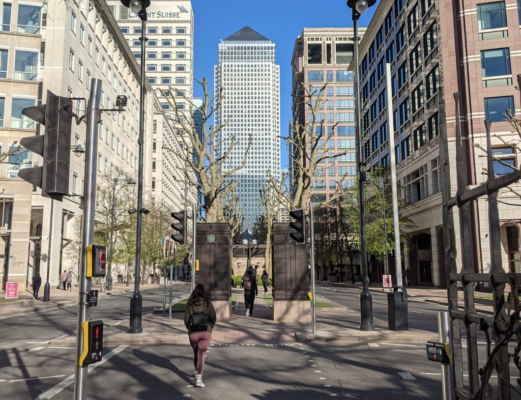
On-site evaluation: Canary Wharf has a good amount of sign posts, totems and interactive points that help navigation. However, other elements within the city fabric negatively affect legibility in the area. In particular, the identical architectural style of the majority of the high-rise buildings, located in the core of the area, make it hard to create memorable routes. When, for instance, all tall glass buildings look similar, it is very hard to tell them apart.
Another disadvantage of the area, in terms of legibility, is the water. Normally, water tends to help wayfinding because it acts as a barrier along which different elements are placed. In the case of Canary Wharf though, the distribution of water does not give a single barrier but many; the water, in the form of canals, is found in many places around the area, not just one. This, combined with the fact that Canary Wharf area seems to be mirrored along the main dock with some identical buildings and water on both sides, creates far more confusion than it resolves. Being a local resident in the area and frequenting Canary Wharf for quite some time now, I have felt this confusion too, and I still feel it from time to time. Equipping the place with a good system of sign posts and totems is not enough to improve legibility; the urban fabric and its configuration should also do their part.

Integration with the surrounding neighbourhoods. Integration of a place with the surrounding communities is an important principle with a great impact on social, economic, transport and cultural aspects. When an area is well-integrated into its surroundings, then, the people that are living in and around it, feel included.
Relevant policies in the Local Plan: D.DH2 Attractive streets, spaces & public realm & S.SG1. areas of growth & opportunity within Tower Hamlets.
On-site evaluation: Canary Wharf faces some natural challenges. Being built where the former canals were, the water remains the main element that separates the area from the surrounding neighbourhoods. However, the existing pedestrian bridges and road network offer a level of connection with more design projects being put forward to improve it even more. There has been a general direction towards making Canary Wharf more accessible to the surrounding neighbourhoods and offering more opportunities for entertainment and retail. Indeed, during the last years, a good number of shops and restaurants have opened in the area bringing the place to life even during weekdays.
Canary Wharf has to deal with social and natural challenges that undermine the area’s smooth integration into its surroundings. The massive property boom and the constant rise in house prices has created friction between the new tenants and the old communities of the Docklands. Thus, the main goal today is to create the conditions for a peaceful coexistence for both communities and to eliminate any feeling of exclusion that people might have.
Building massing & heights. Building heights and massing is an important element for an area and it also contributes to its local character.
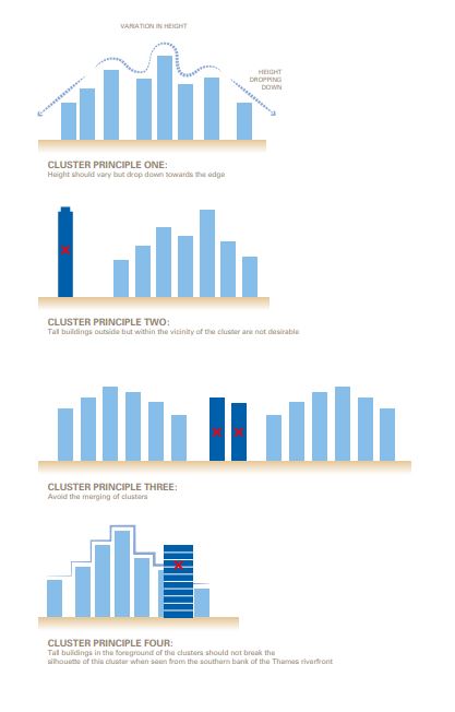
Relevant policies in the Local Plan: D.DH6 Tall buildings.
On-site evaluation: The vision for Canary Wharf was to create a financial centre and what’s a better way to do this than just adding high-rise buildings. Thanks to America, when we are thinking about a strong economic centre, the first thing that comes to our mind is high density schemes and skyscrapers.
Canary Wharf is within the Tall buildings zone identified by the Tower Hamlets borough. However, there are certain principles that need to be followed, as shown in the diagram, providing guidelines on the appropriate height and location of the tall buildings in an area. In relation to the surroundings, high-rise development schemes are required to step down towards the edge of the zone in order to better integrate with the lower densities nearby.
It is true, the density of Canary Wharf surpasses the one of the surrounding neighbourhoods and this is one of the complaints coming from the local communities. This is totally understandable, however the vision for the area is clear and it is the same as the one that The City has; place-branding for a strong financial centre. However, elements like open spaces, wide pavements, minimum presence of cars, or the transparent, glass, material that dresses most of those buildings help mitigate the strong presence of high-rise buildings in the area.
Eco-design. The discussions about environmentally friendly developments are getting more and more attention and eco-design has been put on top of the agenda. When talking about eco-design, we do not only refer to trees and open spaces, but any component in the area that can contribute to an eco-friendly outcome; streets, alternative means of transport, building materials, water management, recycling, noise etc.
Relevant policies in the Local Plan: D.DH2 Attractive streets, spaces & public realm, S.ES1: Protecting and enhancing our environment, D.ES2: Air quality, D.ES3: Urban greening and biodiversity, D.ES4: Flood risk, D.ES5: Sustainable drainage, D.ES6: Sustainable water and wastewater management, D.ES7: A zero carbon borough, D.ES8: Contaminated land and storage of hazardous substances, D.ES9: Noise and vibration, D.ES10: Overheating & D.TR4 Sustainable delivery and servicing.
On-site evaluation: Canary Wharf has been created on high quality standards and the plans for a sustainable future are constantly monitored and improved. In particular, Canary Wharf Group has set out the 2030 vision including strategies for sustainable evolution. Already in 2017 the figures are: £1.59bn of business generated for local SMMEs since 1997, 41% of Group spending was on local companies in 2017, £17.5 million total investment in community engagement projects since 2009, 100% of CWG electricity (450 million kwh) from renewable sources since 2012, 10.7% reduction in energy use since 2016 and 450,000 coffee cups recycled in 2017.
Design can play an important role in a more sustainable future not only in terms of tangible measures and improvements in building materials, techniques, drainage etc, but in intangible ones as well. Building an eco-friendly attitude is a long process with a long-term impact. An eco-friendly attitude can expand to many aspects affecting so much more than just a decision about building an eco-friendly house. It also includes promoting a lifestyle towards sustainable transportation, recycling, respecting the open space and green elements or using eco-friendly materials in your daily life. All these decisions can be encouraged via design. Wide pavements for people to walk, well-connected pedestrian and cycle networks for people to choose over a car, green routes, wayfinding elements and social events to promote recycling etc. are only some examples that can encourage an eco-friendlier attitude.
FINAL THOUGHTS & CONSIDERATIONS
The principles presented above summarise, more or less, the pieces of the puzzle that can have an important impact on how people perceive a place and the quality of life that a place itself gives to the people.
It is important that the vision is aligned with the place-branding strategies. These two combined, create a strong sense of place by either bringing past qualities on the surface or creating new ones as part of a regeneration scheme. In any way, the place needs to tell a story to the people and try to create as little confusion as possible. The vision and place-branding for Canary Wharf was clear and straightforward since the beginning; regeneration of the deprived docklands and creation of a mixed, vibrant financial, commercial, retail and leisure hub. Then, the design strategies and principles came to enforce the vision.
Tall buildings were raised and high standard architectural techniques were implemented in buildings and open spaces to create a modern business centre. However, during the passing of time, it was clear that the place-branding needed more than that to be sustainable; activities needed to be extended outside the working hours. Consequently, more retail and active uses came to attract more people, improve nightlife and bring more activity. Then, Canary Wharf became a shopping and entertainment destination too; being a business centre does not merely imply offices and workspaces but also break-out areas, cafes, restaurants, open spaces and retail. The gateways and control points also do their part making it absolutely clear that you are about to enter a business area. In the same way, when arriving in the area from the tube or DLR, you are directly put in the centre of the business activity, staring at One Canada Square building, a symbolic structure of the area. When walking around the area you can feel the generous open space and public realm where the presence of cars is limited. Big logos for each company can be clearly seen from a long distance giving you an idea of what kind of businesses there are in the area. Bars, cafes and restaurants offer entertainment after a long workday and instagrammable events during the weekend attract visitors from all around London. Overall, the configuration of the place, every little design detail, helps bring the message (vision) across. However, there is always room for improvement…
Canary Wharf has proved to be resilient and open to changes like the time demands. It seems that on-going strategies are trying to better shape the vision for the area and more planning policies are added and implemented to serve this. However, the main issue and challenge for the area is how accessible it really feels to the surrounding communities. Lack of accessibility leads to feelings of exclusion and this constantly undermines the relationship between new and old communities in Canary Wharf and its surroundings. This is the essence of gentrification and there is a fine line between regenerating an area or gentrifying it. The solution lies along the borders of the area.
Till today, the levels of permeability are high within Canary Wharf and low along its boundary line which makes the area feel more like a territory where nothing happens along its boundaries. This is exactly what needs to change; the boundaries of Canary Wharf should be seen as borders, not boundaries, where anything can happen. As Richard Sennett has stated, the boundary is a limit that separates one territory from another, whilst the border is a zone of interactive edge between territories; boundaries are hard whilst borders are permeable. Therefore, any boundaries should be turned into borders and one way for this to happen, in this case, is through pedestrian permeability and enhanced green links as mentioned above. Proposals for more connections to the north, east and south could enhance accessibility and start eliminating any feeling of exclusion that surrounding neighbourhoods might have. It is true that new developments adjacent to other settlements can bring, if designed properly, many benefits to the existing communities in terms of facilities, transport connections, footpaths etc. and improve the quality of the area.
It is therefore important that a set of design principles is in place to keep track of the design outcomes and spot possible issues that need to be addressed. As far as the urban evaluation of Canary Wharf is concerned, it seems that the area is not merely a place to work, but other qualities are also present aiming to create a vibrant and accessible hub to everyone. There is a good alignment and communication between vision, strategies and design tools and any issues have already been identified and added in the to-do list. This might be only half of the work that is needed to be done, but it is a good starting point.
LISTS OF FIGURES & OTHER LINKS
- Figure 01: Reference: https://www.towerhamlets.gov.uk/Documents/Planning-and-building-control/Strategic-Planning/Local-Plan/Introduction.pdf, p.29.
- Figure 02: https://www.towerhamlets.gov.uk/Documents/Planning-and-building-control/Strategic-Planning/Local-Plan/SubArea4IsleofDogs.pdf, p.249.
- Figure 04: https://www.towerhamlets.gov.uk/Documents/Planning-and-building-control/Strategic-Planning/Local-Plan/PoliciesPart2.pdf, p.141.
- Figure 12: https://www.towerhamlets.gov.uk/Documents/Planning-and-building-control/Strategic-Planning/Local-Plan/PoliciesPart2.pdf, p.188.
- Figure 20: https://www.google.com/search?q=canary+light+installations&rlz=1C1GCEA_enGB857GB857&sxsrf=ALeKk03QXQwb8yjGLWOeD18D8DCcQsOVpg:1618144893635&source=lnms&tbm=isch&sa=X&ved=2ahUKEwj4xdG8m_bvAhU1_rsIHQKWDO4Q_AUoAXoECAEQAw&biw=1920&bih=937#imgrc=KZnpgMZaf2x4LM.
- Figure 22: https://www.towerhamlets.gov.uk/Documents/Planning-and-building-control/Strategic-Planning/Local-Plan/PoliciesPart1.pdf, p.63.
- Figure 23: https://www.towerhamlets.gov.uk/Documents/Planning-and-building-control/Strategic-Planning/Local-Plan/PoliciesPart1.pdf, p.64.
- https://london.wikia.org/wiki/History_of_Canary_Wharf#:~:text=Construction%20of%20Canary%20Wharf%20began,phase%20one%20completed%20in%201991.
- https://canarywharf.com/
- https://en.wikipedia.org/wiki/Canary_Wharf
- https://www.ice.org.uk/what-is-civil-engineering/what-do-civil-engineers-do/canary-wharf-redevelopment#:~:text=The%20Canary%20Wharf%20redevelopment%20shifted,in%20as%20well%20as%20work.
- https://worldsmartcities.org/urban-redevelopment-of-canary-wharf/
- https://group.canarywharf.com/wp-content/uploads/sites/2/2014/04/Social-and-Economic-Development-Strategy.pdf
- https://www.londoncityisland.com/the-docklands-story/
- https://www.towerhamlets.gov.uk/Documents/Planning-and-building-control/Strategic-Planning/Local-Plan/SubArea4IsleofDogs.pdf