First observations and other remarks on place-making after a short trip to Budapest
Not long ago, I visited Budapest on a short 4-day trip. Truth to be told, I was already sold on this place, before visiting it, as there is so much positive feedback regarding its beauty and rich architecture. In fact, Budapest is practically a living museum thanks to the variety of architectural styles including baroque, art nouveau, bauhaus, as well as socialist classicism, also known as ‘Stalinist architecture’. On the other hand, little has been said about the urban design aspect of the city, for instance, the city’s relationship with the river, the quality of the public realm, the infrastructure, the street networks and patterns, the landscape and the topography. All these elements, including the architecture and built form, create the ‘sense’ of a place and they therefore, play a significant role on how a person perceives an area. Thus, I thought that a blog post about my personal take, from an urban architect’s perspective, on the place-making in Budapest would be useful to help put all the pieces together and show the big picture of this city that goes beyond architecture. My view could be summarised under three themes; the distinct character of Buda and Pest, the challenging coexistence of different means of transport on the carriageway and the ‘filtered’ relationship that the city has with the river.
BUDA’S AND PEST’S DISTINCT CHARACTER
Each side generates a different feel which ultimately contributes to the character of the whole city. With the main transport infrastructure being located on the Pest, this side can be identified as the main entrance to the city. In particular, the airport is located approximately 16km to the east, whilst Keleti main international and inner city railway station and Nyugati station are also found to the east. Now, this may sound like a positive feature, however, this condition includes, or maybe attracts, some less ‘sexy’ attributes, for instance, more highways, higher building densities and therefore, increased traffic congestion, noise pollution, as well as less green coverage compared to the Buda side. Overall, Pest is considered to be the main city hub, where all the activities and businesses happen, and for that reason it attracts the above characteristics. However, at the same time it also acts as a buffer/reception zone for Buda which shares a complete different feel. More specifically, in Buda, the transport infrastructure is lighter, partly due to the challenging topography, whilst the street patterns have grown organically within the urban fabric. These elements create the impression of a more ‘natural’ place where the architecture can be appreciated to its fullest thanks to the topography and the meandering layout of the streets that produce evolving vistas, long-distance views and breathtaking perspectives. Pest, on the other hand, being flatter, offers less perspective views, but a greater element of surprise in every corner where one can discover small pockets of pleasant places to stop by, rest, admire or take a photo.
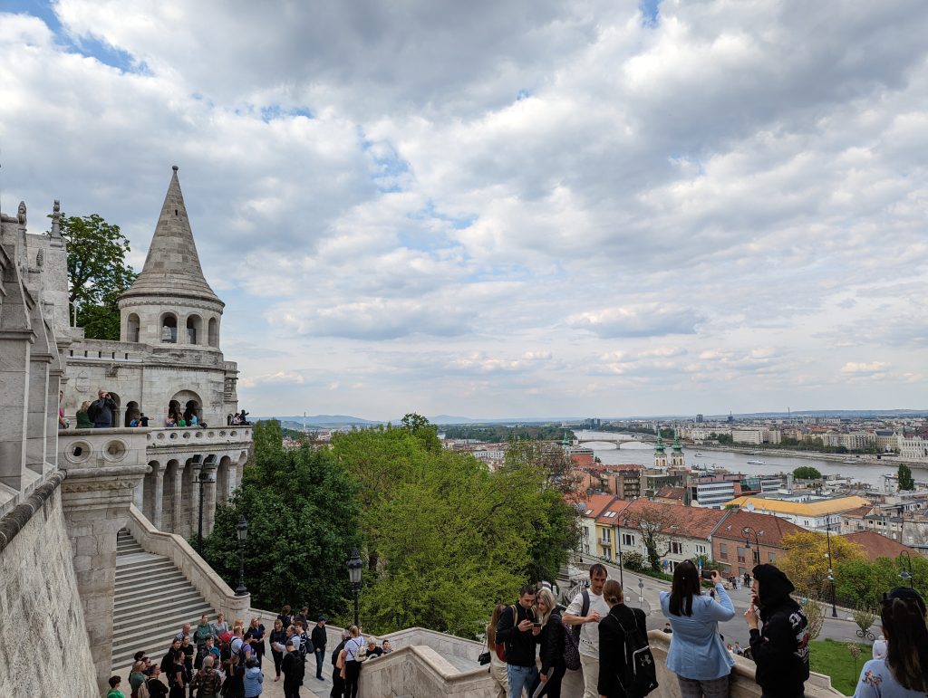
In terms of legibility, although both sides are bordered with the river, which as a natural barrier contributes to the legibility of a place, Pest does a lot better on that aspect due to the more orthocanonic arrangement of the blocks and layout of streets. This layout allows for permeability of movement and therefore, helps navigation. When walking around Pest, there is no need to constantly check your GPS since you can approximately find your way around, as long as you know the direction you are going. Buda, however, can be trickier to move around without a GPS due to the organic layout of streets and lack of permeability and signage. For instance, even though these long-distance views towards Fisherman’s Bastion might make you believe that there is a straightforward route up, you would be surprised to know that one wrong turn might lead you to a dead-end or even worse further away from your initial destination, which can be upsetting. Having said that, I can guarantee that it is more pleasant to get lost in Buda than in Pest, as long as you have strong legs to cope with the hilly landscape.
Looking at Budapest as a whole city, the feeling I get is that each side complements the other offering a variety of qualities for every taste. Pest, as a city and business hub, offers good connections within and outside the city, a range of facilities and options for all-day entertainment, whilst Buda offers nature, landscape, beauty and tranquility.
MEANS OF TRANSPORT
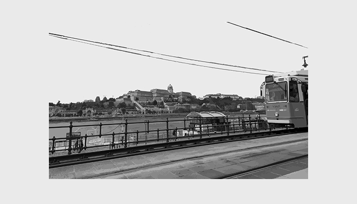
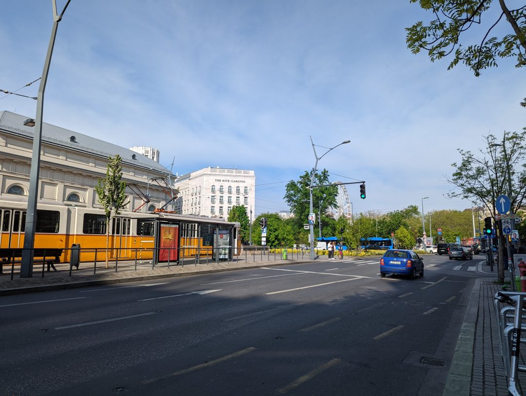
I believe there is something very interesting going on with the available means of transport. Budapest is the second city I visit, after Milan, where the carriageway is shared by more means of transport than the usual ones we come across in cities. More specifically, the tram is the extra piece in that case, which is also an important feature of the city, equipped with over 40 lines running throughout the historic centre. It is a popular means of transport, both for locals and tourists, as it offers a panoramic ride of the city centre and short and long distance views. However, from a place-making perspective, the more means of transport occupy a road, the wider the road needs to be to accommodate them, since most of those means require a dedicated lane. Consequently, as the roads get wider, the pavements usually get narrower, whilst the noise pollution and traffic congestion deteriorate. In addition, more means of transport also means more traffic lights and therefore, more layers of complexity for pedestrian movement. I vividly remember myself in Milan, trying to cross a road where vehicles, buses, trams and cyclists were passing by; the level of confusion was massive and the same story was repeated in Budapest. Although, a variety in means of transport translates into a variety of options for people, the place-making aspect needs to be also taken into account, since, at the end of the day, what matters the most is how people perceive a space, and the streets play an important role in that. A street needs to be safe, inclusive, well planned and contribute to a high quality of life minimising air and noise pollution, whilst offering a good range of options.
RELATIONSHIP WITH THE RIVER
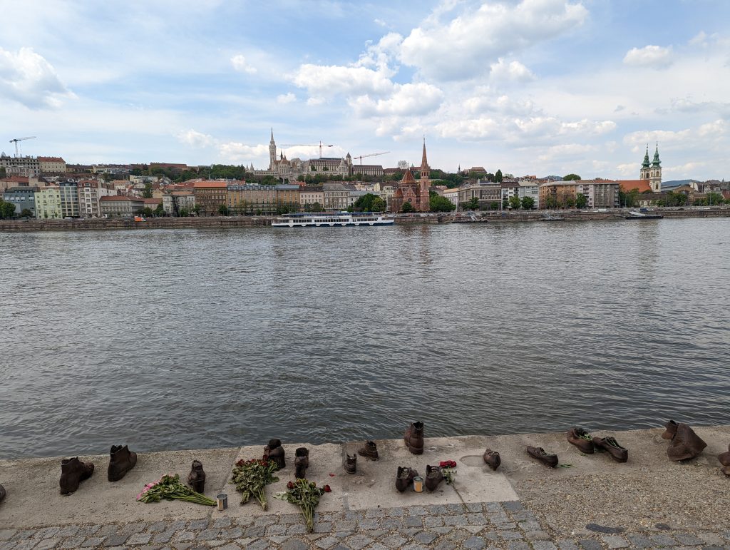
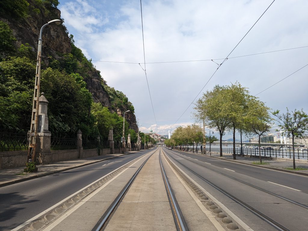
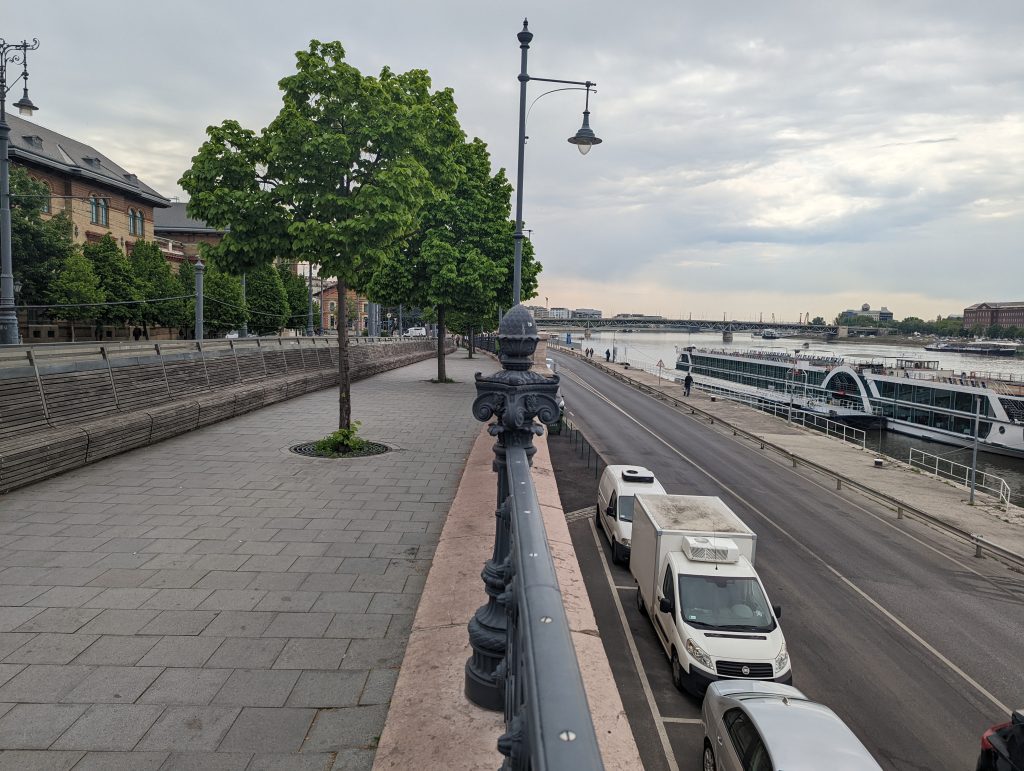
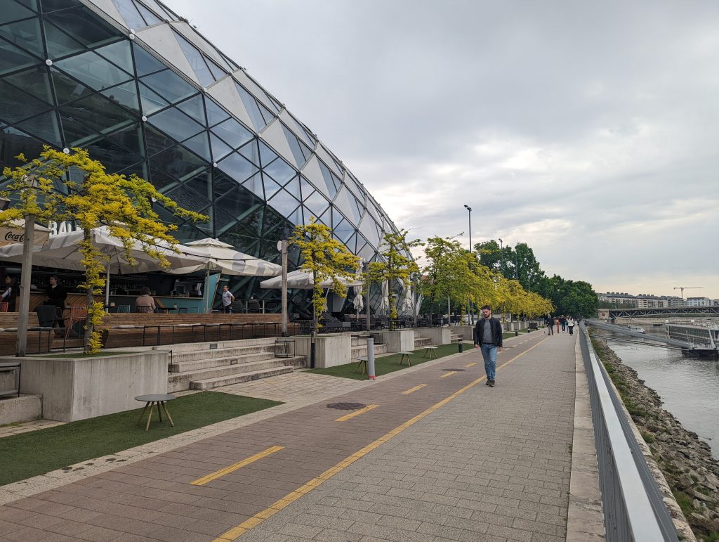
The potential issues that the multiple means of transport create are not limited only to the public realm, but they expend to the relationship that the city has with the river. More specifically, what the wide, boulevard-style, streets in the city centre and the riverbanks have in common is that both environs feel car-dominated with less attention being paid to the needs of the pedestrians. The main promenade along the riverfront, is not actually set along the riverfront, but it is separated from it by a street and, occasionally, tram lines, whilst on top of that it is also, at most parts, elevated from the ground.
All these layers between the river and the promenade create a fragmented environment where the relationship with the river is not direct. Having said that, there is also a pavement running along the river on the ground level, right next to the street, however it does not have the appeal of the promenade. In particular, the low quality of the public realm in terms of width, lighting and paving materials and the fact that it is separated from any other active uses, creates a less attractive environment compared to the elevated promenade. In addition to this, during the night hours, these pavements encourage other types of social gatherings and antisocial behaviours that create a less safe environment for people, whilst during the day, the same environment resembles a port rather than a pleasant walking path.
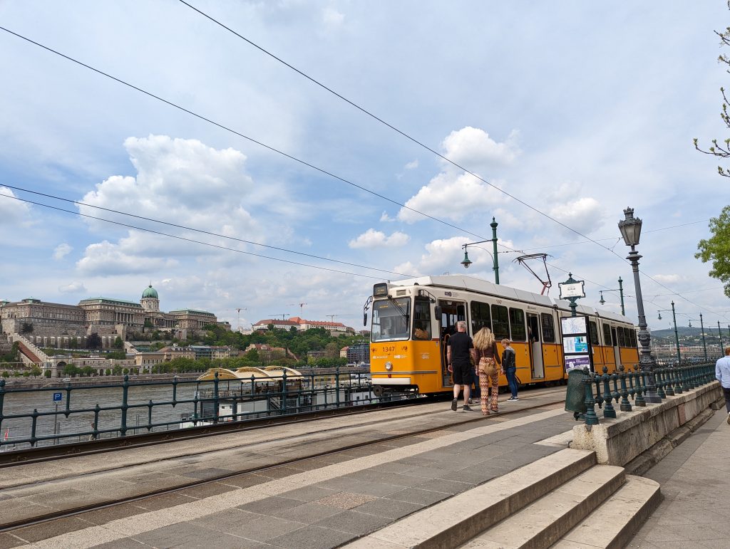
However, there are parts along the riverfront where one can find high-quality ground-level public realm equipped with seating areas, lighting, trees and vegetation. More specifically, this is the case along Orszaghaz government building, Szechenyi Istvan ter or Balna Shopping Centre, where people are free to walk literally along the river without having to worry about the cars. It is important to note that what all those cases have in common is the absence of the tram line along the riverfront which frees up the space by eliminating an important barrier and offers better pedestrian flow.
River cruises along the Danube is another element, though an artificial one, that feeds into the relationship with the river. Those cruises, which is a must-do when visiting Budapest, take passengers along the river, in both directions, showing the city and the landmark buildings. If only the walk along the riverfront was as smooth and continuous as those river cruises…
FINAL THOUGHTS & CONSIDERATIONS
All in all, if I could summarise my personal take on place-making in Budapest in one sentence that would be: ‘An introverted city which either hides its precious jewels within the city fabric or exhibits them from distance’.
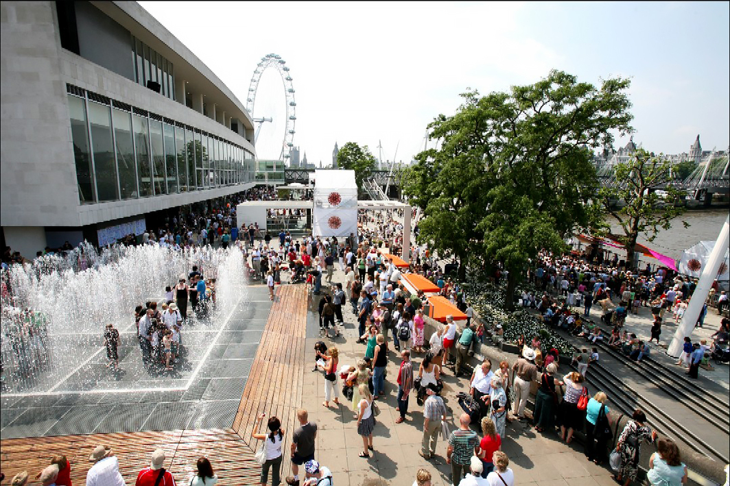
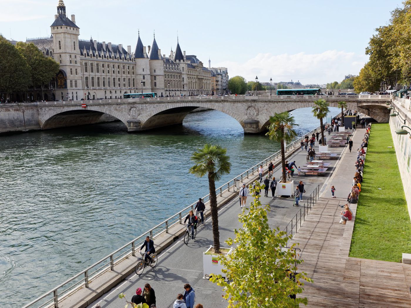
On the contrary, an extroverted city has a quite different approach. Extroverted places are legible and attractive places that welcome people and offer opportunities for relaxation instead of confusion. It is places that enhance permeability for all users, encourage shared environments, whilst prioritising pedestrians (and cyclists), and lastly, it is places that understand their key strengths (natural or artificial elements) and brand them, as well as kindly offer them to the public. For instance, two good examples of extroverted cities are London and Paris. Both cities, apart from many other strategies, have taken advantage of the rivers, Thames and Seine respectively, and have implemented a series of place-making strategies along the riverfront to make it more accessible and attractive to the people. These strategies include widening the public realm, adding active uses, markets and seating areas along the riverfront, as well as organising events or improving signage and so on.
To conclude, Budapest needs to open up to its locals as well as the visitors and become more accessible. A holistic place-making strategy would benefit the city aiming to make the riverfront more accessible for its users. Good examples from other cities need to be referenced to draw inspiration. There are already some good place-making examples in place, however, more is needed to trigger any positive change.
LIST OF FIGURES
- Figure 10: https://www.artforum.com/news/london-s-southbank-centre-likely-to-remain-shuttered-until-april-2021-83115
- Figure 11: https://archive.curbed.com/2016/9/27/13080078/paris-bans-cars-seine-right-bank-air-pollution-mayor-anne-hidalgo